Thur. 6/15.
Drove on. Did not stop at Oak Alley or other popular plantations (aka, farms) in the area.
Fri. 6/16.
Drove last 100 mi. or so to McKinney TX. The “inn” (Bob’s son Aaron’s house) was full, so we stayed at local RV resort today & tomorrow night. Pretty tightly packed spots for a $45/night “resort.”
Sat. 6/17.
Lunch in downtown McKinney. The bank with eagle on top of its building opened 1868—surprised that Texas post-Civil War wasn’t too depressed economically for a new bank. Double baby shower in the evening for daughter-in-law Malia and her sister Summer.


Sun. 6/18 to Wed. 6/21.
Hanging out in McKinney. About this time we realized we might have to modify the itinerary–been out 2 months now and not even half way around the country. Dropped southern Utah–so many national parks there, it would take weeks to see them all, need to come back another time. Skip Washington state for now and sights along the Canadian border.
Thur. 6/22.
Driving to San Antonio. Still crazy hot here–107 degrees today. And crazy highway interchanges–pretty with 4-5 layers of overpasses soaring everywhere, but tricky to navigate. Stopped at the locally famous Little Czech Bakery; accident in parking lot, no injuries, car is a little banged up.


Fri. 6/23.
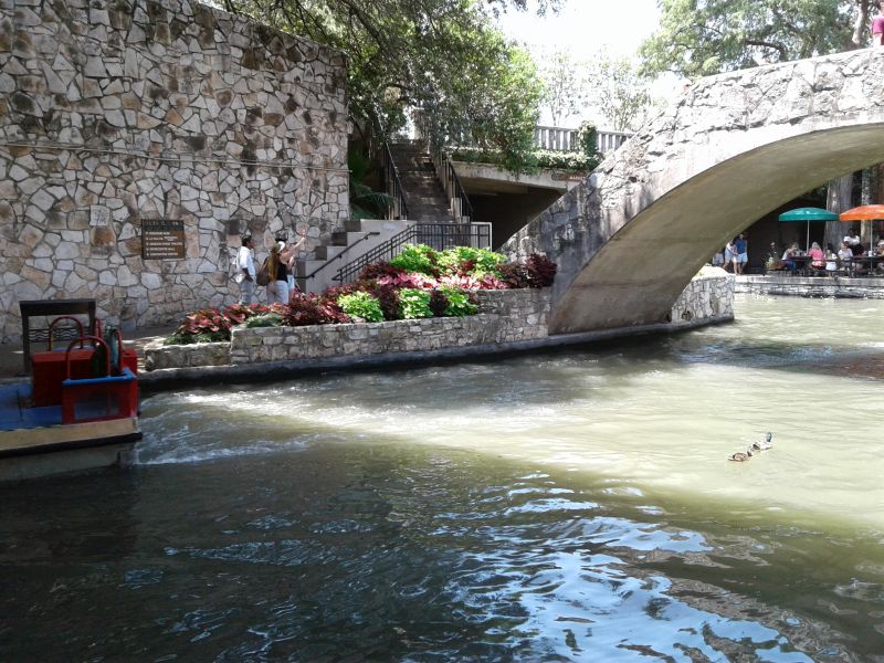
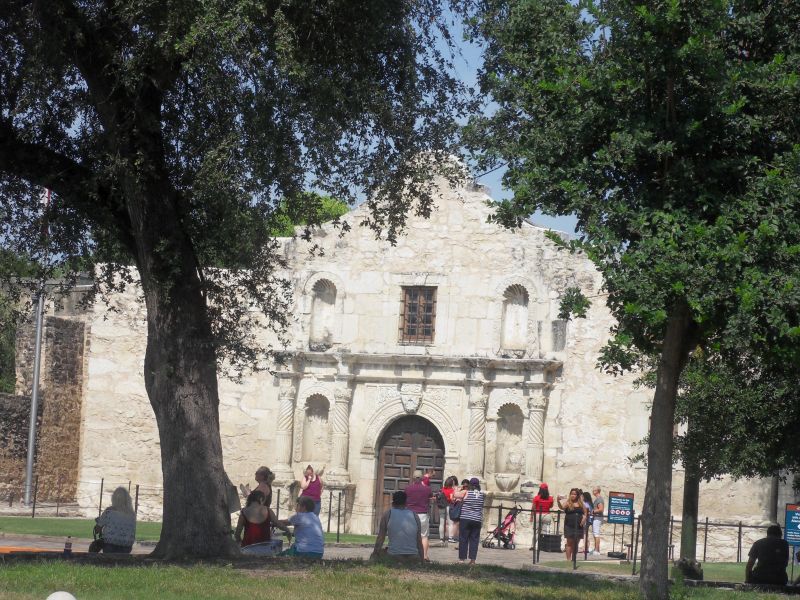
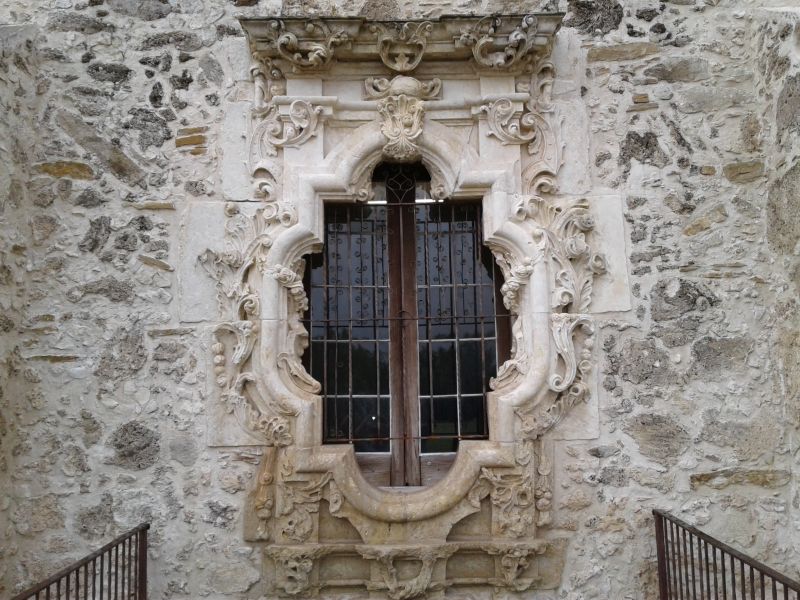
Did the River Cruise in San Antonio and walked up and down the very scenic Riverwalk. Had dinner with Aaron. Also did a quick walkaround of the Alamo plaza.


Sat. 6/24.
Trip with Aaron to New Braunfels (a German settlement) and Mission San Jose. By 1700, Spain had settled from Florida to California, and as far north as St. Louis.
Learned that the success of any mission depended on crops. Sparse rainfall and the need for irrigation led to 7 gravity flow ditch systems called Acequias. 5 dams and several aqueducts along the San Antonio River ensured the flow of water into the system. In Spanish Texas, water was so important, land was measured in suertes or the amount of land that could be watered in a day.


Sun. 6/25.
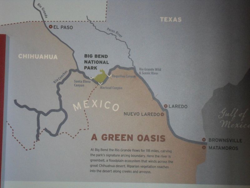
Enroute to Big Bend NP. 275 miles straight west to Sanderson, TX.


Mon. 6/26.
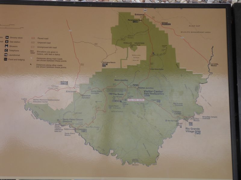
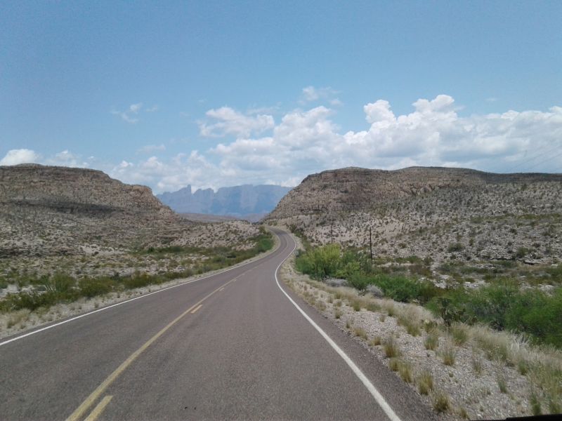
Drive another 54 miles west to Marathon, 42 miles south to park entrance / Persimmon Visitor Center (VC closed in summer), 49 miles to the Boquillas Canyon and Rio Grande overlooks (VC closed in summer), back 23 miles to Panther Junction, west 26 miles to Maverick Junction (VC and gas station were open here) and north out of park 58 miles to Alpine TX (such a nice name for town here in the desert). Total 252 miles. Sally was careful to plan for NOT getting stuck in the park overnight.


Learned about the mid-19th century U.S. Army Camel Experiments and camels’ superiority as pack animals in western desert areas. And even out here there were natural water holes, used since ancient times and more recently by ranchers, cowboys, and border patrol.


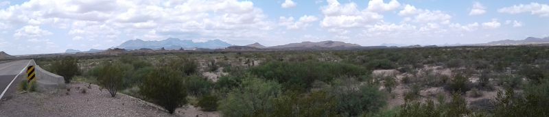
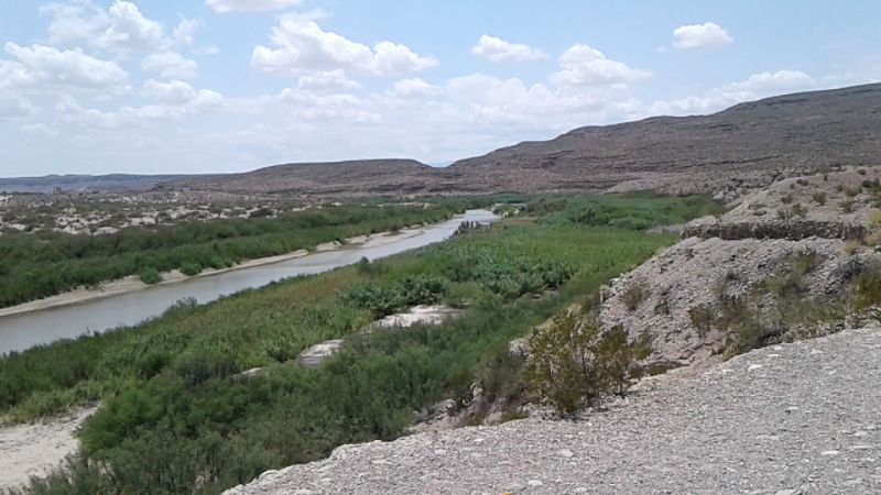
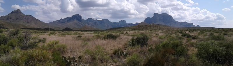
For eco-buffs: The park has a wide range of habitats. from 1,800 feet at its lowest point–the Rio Grande River–to 2,387 feet at its highest point–Emory Peak in the Los Chisos Mtns. Learned about efforts to restore viable rangeland destroyed by overgrazing, field crop production and modifications to natural drainage.


 can take oxygen from air as well as water")
")


